|
Chóra - Stavrós - Kallítsos - Moní Taxiárchoon - Galaní - Panagiá - Chóra |
||
| Evaluation:
This rather long hike through the interior of Sífnos was, some time ago, definitely the
most beautiful hike on the island.
You do not only see the most interesting villages, but you can
also visit the monastery of Taxiárchoon; in addition, some of the trails
belong to the nicest ones in the whole of the Cyclades. But unfortunately, some trails between Kallítsos and the monastery are blocked - so you have to follow the asphalt road for 25 minutes. A part of the trail between Galiní and Panagiá was destroyed by the construction of a gravel road and, finally, you have to follow the asphalt road between Panagiá and Gýtfika for another 26 minutes. So, this hike that definitely got an evaluation of *** now only gets **... [Updated by Raymond on September the 8th, 2012.] Estimated time: You should devote a long day to this hike, in order to take into account the necessary rests. In actual hiking time it will take you some 45 minutes to Páno Stavrós and then 40 minutes to Kallítsos or Kéndarchos. Thereafter it will cost you about 45 minutes to arrive at the monastery and another 10 minutes to get to Galaní. It costs about 50 minutes to reach Panagiá and then finally it will take you about 1h20 till Chóra. This actual hiking time of 4h25 thus refers to a long hiking day of about 8 hours. This means that you definitely have to catch the 10am bus. If you depart from Livádi, you have to leave even earlier, around 8 - 9 am.
Route description: By
supposing you will set off from Chóra, we start this hike on the bus
square of this village. [When you do leave
by going on foot from Livádi to Chóra first, we refer to the route
description of the
hike Livádi-Chóra-Livádi. (0h00) In between the
shop of Michail Bofilios and the kafeníon I Mili (The Mills) there is a
flight of steps going down steeply. These steps bend to the left
immediately and after 10 metres you go further down on a concrete path
off the right. This path descends steeply again to the left after some
20 metres (big red dot) and then finally turns into a
paved street. A little further you will see a small red-and-white sign
with the number 1 on a telephone pole – you will see this indication a
couple of more times on this hike. A little further,
you have to keep to the left at a vague bifurcation,
alongside a kind of wall. The trail is clear and it descends
to a stone bridge, painted in white. To the
left of this bridge there is a watering place with a tap
– on the balustrade of the bridge you will again see a sign with the
number 1 and 2 big dots. (0h11) The trail goes up
again now, sometimes it even turns into a nice flight of stone steps, a
kalderími. Almost on top, at the foundations of a stone building, there
is a path to the right (to Livádi or Psili Ammos, see the
hike Chóra - Psíli Ammos).
Our trail, however, goes straight (there is also another sign with the
number 1), in the direction of a chapel with a small arch. The views on Chóra
behind you and on the bay of Livádi get the more and more
beautiful – and in the valley on the right you see a large stone
bridge, which you would have crossed had you taken a right just a moment
ago. Ten minutes after the watering place you get to the top at the
chapel. Now, the trail descends straight to a second valley with a
bridge with an ugly metal balustrade. You reach this bridge after
another 5 minutes and the valley is fairly green, even in Summer. This
is the valley which is crossed by the large bridge we saw a on the right
some time ago. In this valley there are some puddles with frogs, which
you can reach on the hike to Psíli Ammos. (0h25) Your next objective now is the chapel with the little blue arch and the house above it, which you see halfway to the top of the big hill on front of you, a hill with lots of aerials on top. The trail clearly continues in between walls, but after some minutes we get to a rocky field, with a little valley in the middle. There are two paths and you take the left path, to the left of the valley (red dots). A little further, you have to pay attention and you have to go up on the left in the
direction of two stone walls (you will also see red dots and a sign with
the number 1). These two walls go towards each other in a funnel-shape
– still in the direction of those aerials.
The chapel of Páno Stavrós, between Chóra and Kallítsos. You reach this
chapel after a climb of some 15 minutes of easy hiking.
Just before you reach the chapel, you get to a recent gravel road: you
follow it to the left for one moment, and then you zigzag towards the
chapel. (0h43) At this chapel a
beautiful kalderími starts off and you will follow this one until
Kallítsos. You go up gradually, in a rocky and very impressive
landscape with great views on Agios Ioannis, Psili Ammos, Livadi, the
little island of Vous, Sífnos and Chóra behind you. The kalderími between Chóra and Kallítsos Sometimes, there
are nice curbstones, and after some 17 minutes, there is a stretch with
a beautiful pavement. You might even
wonder who has ever put all this work into this wonderful trail. After a
climb of about 25 minutes you reach a pass on a protruding cape; you can
now see Kallítsos and also the large road above it. Parallel to this
road there is the trail you will follow later on, leading to a hamlet
with some grey stables in the distance, and then even further to the Moní
Taxiárchoon.
(1h05) You
descend to Kallítsos for about 10 minutes and in the end the long,
beautiful path reaches the asphalt road that was constructed in
2003. Some 100 metres in front of you, you can notice the first houses
and there is also a large, red dot. You follow the road for a short
while and when you get to the sign Kallítsos you go down the brick
staircase on the right (note the large red dot) – this staircase gets
to the old trajectory of hike no. [1].
You
enter the village by taking a sharp left and you continue going down the
staircase towards the ‘centre’; you pass some 2-3 streets
off the right and by going straight you will finally get to a kind of
square. Over there you will find a tap where you can freshen up and a
wall where you can eat your sandwiches in the shadow – unfortunately
there is no tavern or café. But still, this is a lovely spot,
underneath some palm trees and pines, isolated and peaceful. (1h22) After the break in
Kallítsos, you leave the square by going straight, towards the east.
Very soon though, you take some steps going up on the left and in this
way you leave the village. Five minutes later you arrive at some stables
and you will get a beautiful view on the bay of Kallítsos. On the other
side of the bay you see the trail that leads from Kallítsos to Agios
Ioánnis. About 8 minutes out of Kallítsos you pass a deserted hamlet
– the concrete road (1h39) Some
5 minutes later you arrive at this church with a blue dome. Deep
underneath you can distinguish a very nice natural little port - it is
Platýs Gialós. You get
to a road that meanders downwards, but you follow this road upwards to
the left.
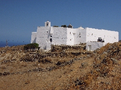
The Moní Taxiárchoon, close to Kallítsos. You can enter the
monastery through a very low door – if there are not too many tourists
the only remaining monk will offer you some loukoúm and he will show you
the church with its beautiful ikonostási, originating from 16th century
Russia. (2h06) After the visit
you follow the road further to the right: after 3 minutes, you keep to
the left at a bifurcation, and soon you reach a bus shed. Over there you take a modern flight of steps
going down off the right towards the not yet visible village of Galaní.
You descend about 90 steps and then you arrive at the village; you cross
a concrete road and you continue down until you arrive at the church with
next to it an enormous concrete cross. You can take a little break now, admiring the beautiful view
on the bay of Sikamiá - you can have a picnic here. (2h14)
From the church onwards you go straight and
you just follow the trail markers [6], in the direction south-southwest;
you descend the staircase to the right [6] and another steep staircase,
until you get to a side-street ([6] on a pole). To the right, you could
go to the beach of Sikamiá - see the hike Pýrgos - Galaní - Sikamiá -,
but you have to take a left here . At the outskirts of the village you
follow the concrete road to the left, marked by means of a trail marker
[6]. In front of you there are two valleys, with two chapels with a blue
roof. You will now first follow the concrete road on the left-hand side
of the left-hand valley. When you get to the final house you find a path
off the right (twice the trail marker [6] and a red arrow to Pýrgos): in
this way you easily descend into the valley, but after 4 minutes, you
pass a path on your right side. You then go up again on a sometimes
beautiful path - you keep to the right at a bifurcation. |
You get to the
gravel road, where you go to the left for some moments, and then you
continue up to the right, BEFORE the palm tree (trail marker [6]). A little later on you walk next to a
house, underneath eucalyptus trees, and you pass on the right-hand side
of a small chapel with a blue roof. You thus climb until you get next to
a house, and just past the house, you have to go up to the right on a
rocky path [6]. A little further, you keep to the right (no mark), and
you reach in this way
a
gravel road - there is a chapel further on to the right. (2h45) At this point you leave hike [6] and you go to the right on the fairly recent gravel road – this road had destroyed the ancient trail. You follow this road for about 11-12 minutes and then, without any difficulties, you arrive at a concrete road. This road comes from the cemetery of Panagiá. (2h57) You DO NOT proceed straight ahead on a path going down, but you follow the road to the left for about 30 metres. You then take a rocky gravel road to the right. This road curves to the right and it describes a large bend around the valley, underneath the houses. After 6 minutes you find a steep and narrow trail on the left and 3 minutes later you arrive higher up in the village. Fortunately, the first house on the right is still the old café with a small shop, where you can drink something or even eat an omelette or a salad. (3h06) After your break
you continue straight until you reach the little square next to the
beautiful Byzantine church of Panagiá, dating from the 10th century
A.D.. This church is devoted to the Virgin Mary, with a huge
celebration on the 15th of August.
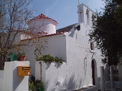
The church of Panagiá.
The church still haves old columns.
The old fresco's are in a bad condition... In the left-hand corner of the small square you continue by following hikes no. [4] and [5] – a hiking sign [5] and the trail markers 4-5 show you the road. You meander to the right, to the left and to the right again and at the following crossing hike no. [5] goes straight ahead, while hike no. [4] takes a left.
The
beginning of the walk [5]. You should now follow hike no. [4] for a short while. You go up the staircase and you continue up the meandering staircase straight ahead. At a certain point you see a large, white staircase on your left – you go up on the left and after 37 steps you arrive at the asphalt road. This is the end of hike no. [4]. You notice a really beautiful and paved trail straight ahead, without any trail markers.
The path from Panagiá to Gýftika. After about 3
minutes the path becomes uneven and stony. Some 6 minutes later you get
to a dusty gravel road; you continue on the other side and you reach the asphalt road. Over there you go LEFT. (3h20) You have to follow this road for quite a long time: after 20 minutes you arrive at a junction: the road on the left goes to Chóra, but you take a right first, in the direction of Méga Livádi. After another 6 minutes you get to a water tank and the sign post to the heliport (the hiking sign pointing to Chóra has disappeared, but there is a small trail marker [2]) – this is Gýftika.
The beginning of walk [2] that returns to Chóra. (3h46) You now take a
left, you follow
the asphalt road for about 5 minutes and
where the road bends off towards the small airport, you take a path in
front of you. This trail goes down gradually in the direction of an
aiguille with a white chapel and a circle of walls. Guided by red dots you reach the chapel after some
15 minutes. From this point onwards you will gradually get a wonderful
view on the other side of Chóra. After descending the trail for some
more minutes you get to a marvelous kalderími. This kalderími is
sometimes even completely paved and it has impressive walls – some
real cyclopean work!
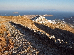
The kalderími to Chóra
A nice view of Chóa in the evening sun... While admiring the
beautiful view on Chóra it will take you some 25 minutes to get down to
the mills and the bus square. At this spot you can wait for the next
bus, you can discover Chóra or you can return to Livádi by taking the
ancient steps... (4h26)
To
get the printer-friendly version |
|


