Chorió - Dékas - Mavrospília - Elleniká and back |
||
| Evaluation:
This is one of the most beautiful hikes you can make on the island of Kímolos.
Not only is the trail during the first half of the hike really
magnificent, but also the two beaches and the amazing rock formations
between the two beaches turn this hike into a memorable event. It
definitely gets an evaluation of ***. [Updated by Raymond on November 9th 2010 and September 13th 2012.] Estimated
time: The way out to the beach of Elleniká will cost you about one hour and a half (AWT). The return road
takes a little longer, so the actual walking time is something like
3h15. Including all of the pauses and a long picnic and swim break, we
hiked for 6-7 hours – from 10.30am tot 5pm. Route description: (0h00) Just like for all of the other hikes you have to leave from the Kámbos. This time you take the little street on the left of the row of houses with the kafenío and the kámara (a vaulted passage). This street goes up and it runs on the left of the Byzantine church of Ioánnis Chrysóstomos.
The platía or Kámbos, the central square of Chorió.
Agios Ioánnis Chrysóstomos. You follow
the first signposts to the "archaeological museum”, you thus walk
on the right of the kástro and then you proceed straight ahead. You
pass underneath a small, vaulted passage, you go straight ahead (not to
the right) and then straight ahead once more when you reach a crossing.
You thus arrive at a side-street, where you take a left. This street
gets to a concrete road – exactly at the point where the road
describes a curve – and over there you go straight ahead again (this
is in fact the road to Alykí). (0h10) You pass a narrow street and then you go up the second street on the right, at a house with a double blue gate and a lot of cacti. Immediately thereafter you turn left and then you keep going straight ahead, climbing slightly – you do not mind the two side-streets on the right. After a couple of minutes the concrete turns into gravel. You reach a crossing where you still go straight ahead and after some 5 minutes you pass on the left-hand side of a simple chapel with a flat roof. Watch out now: some 3 minutes further down you have to leave the gravel road to the left and take a beautiful trail going in the direction of a similar simple chapel. You descend into a nice valley filled with cacti, you then go up again and you continue straight ahead, between walls. You walk towards the chapel, without minding the two side-roads off the left.
The path to Dékas. (0h37) You walk next to the chapel of Agios Pandeleímonas: it is open and from the terrace behind it, you enjoy a beautiful view on the islands of Polýaigos and Mílos.
Agios Pandeleímonas. From
here, the monopáti has been replaced by a little dirt road; after another 3 minutes you keep to the right. You descend into a small valley and you
get to a bed of a river, on the right of a tall wall. You keep to the
left twice and in this way you go up, leaving the bed again. After
another 2 minutes you arrive at a curve of a white gravel road, where
you take a left. (0h45) This
really pleasant gravel road gets to a wider gravel road after some 9
minutes. You take a left for about 10 metres and in this way you get to
an asphalt road, which you follow to the right for some 100 metres –
past a remarkable little rock house,
built between strange rocks with behind it a lot of cacti.
A remarkable ruin on your way to Dékas... (0h57) About
100 metres
further down you go right on an ‘improved’ gravel road, which you
will have to follow for some 19 minutes. After a little over 12 minutes
you keep to the left – you are now walking through a pleasant hilly
landscape with also some agriculture. After another 6 minutes you reach
the sign "Dékas" and the road runs to a dead end. Via the
dunes you arrive at the really beautiful beach. The bay is shallow and
in front of you, you notice the little island of Agios Andréas – this
is a great place to have a swim.
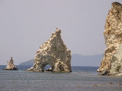
The beautiful beach of Dékas. (1h17) You follow the waterline along the entire beach or you walk on the path that continues above the beach - it begins next to the last little tree on the first part of the beach.... At the end you keep somewhat to the right and you cross a nice cape, by following some vague tracks. You take a left for a while, in order to admire the wonderful erosion phenomena of Koftó and also, a little further, the shining white rocks just before the beach of Mavrospília.
The nice erosion phenomena before the cape of Koftó. |
The white rocks next to the beach of Mavrospília. After having gone to the left for a short while, you return until you
get to a wall. The
trail runs on the left-hand side of a house and in this way you reach a
small gravel road, that continues to the left, along the beach of
Mavrospília..
The beach of Mavrospília. (1h29) You then can descend to the colourful pebble beach of Elleniká. (1h33) The most beautiful
beach is definitely the one of Mavrospília, so you leave the pebble
beach of Elleniká again: you follow the sandy road until you get to the
middle of the sandy beach of Mavrospília. This is a fantastic picnic
spot: the bay is shallow and the water was lukewarm already on the 13th
of May 2008, it was still so on the 3rd of October 2010. When swimming in the bay you have a nice view on the white
rock formations on your left-hand side. (1h46) For
your return route you take the gravel road on the right, just past the
sign "Mavrospília";
a little further, you again take a right and in this way you cross the cape, on the right of a house and a wall. With
a nice view on the rocks in the sea all the way, you arrive at the
elongated beach of Dékas after 3 minutes. You follow this beach
for 6 minutes. About
1 minute past the white rocks you clamber to the strip of sand on your
left and you walk through the dunes until you get to the sign "Dékas"
and the beginning of the white gravel road. (1h59) You
follow this gravel road for another
20 minutes, where you keep to the right after 5 minutes. This is a very
pleasant walk, through the sloping green valley, and finally you get
back to the asphalt road. You take a left and you walk past the strange
rock house. You then go left on the broad road and immediately
thereafter you take a right on the white gravel path. (2h19) You
keep on going steadily, with on the right a nice view on the sea; the
little double island between Polýaigos
on the left and Mílos on the right is the private island of the Ventoúris
family, known as shipowners. In the sharp turn to the left, after 10
minutes, you find your little gravel road again, right in front of you
(blue dot).
(2h29) You descend into a small valley, you keep to the right twice and a little further you leave the valley to the left. You go up again and when you reach a crossing, after some 4-5 minutes, you keep to the left and you continue in the direction of the chapel. Some 3 minutes later you pass the chapel; here starts again the nice monopáti. A couple of minutes later you get to a path coming from the right and you proceed straight ahead. Another 3 minutes later you arrive at a T-junction and you keep going straight on - and so, you pass two paths on your right side, after 2 and 4 minutes. (2h44) After a while you go down on a path which is sometimes nicely paved; you are now walking in a valley with red rocks and with a lot of cacti. Your path between the cacti...
The nicely paved monopáti that leads back to Chorió. From now onwards, you can follow two different itinaries: [A.
(2h51) You could follow the same
route as on your way out: if you do so,
you
keep to the right
and
you climb out of the valley on a steep and winding
trail. A
marvellous climb brings you to a gravel road, which you follow to the
right. You go
up a little more and after 3 minutes you reach the simple chapel with
the flat roof. (2h58) At
the large crossing immediately thereafter you go straight ahead, of
course – since you can already distinguish the row of mills of Chorió
far away in front of you. Some 5 minutes later the gravel becomes
concrete and you enter the village. You pass two small streets on the
left and you reach the asphalt road, where you take a left.
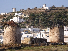
A nice view on Chorió with the Xaplovoúni.
In a curve to the left, after another 2-3 minutes, you go straight ahead
on the broad and paved street. You
then take the fifth street off the right (at a blue inscription on the wall).
You continue straight on, first at a crossing
by keeping somewhat to the left,
and then at a side-street
that comes from the left.
You pass through a kamára (archway) and you go again straight ahead when
a side street comes from the right.
In this way you
go down along the wall of the kástro and you
easily reach the
Kámbos. (3h15)]
B. (2h49)
You
also can follow a
pleasant alternative
path,
that
continues
to the
LEFT
in the bed of the river (blue
mark). The
monopáti
runs
next
to
or
even in the
rocky river bed
(3 times blue marks).
After about 7 minutes,
you keep to the right
in
or next to the
bed
(blue mark) -
it becomes narrower and
deeper, and a little
later,
you again
hold
to the right.
Returning to Chorió. (3h10) This road becomes a concrete street beside the Meltémi restaurant (there are also rooms): you keep going down, you cross a small bridge and you arrive in this way to the right of the church with the blue dome. Here you follow the main street to the right and you arrive after a few minutes on the Kámbos. (3h16)
In
order to get the printer-friendly version |
|


