Ioulída - Lion - Agii Theódori - Sorós - Kastrianí |
||
|
Evaluation:
This hike first
follows the same walking trails as walk [1] to Otziás and as the walk to
Spathí: so you follow the same route up to the Lion and the source of
Venjamin, then you turn right.
Later on, there
are still some beautiful trails, but unfortunately there is also quite a
long part of the walk that follows the road that was paved in 2009
(about 3 km).
Towards the end, there is again a nice trail that leads to the very
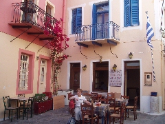
photogenic place of Kastrianí. Route description: (0h00) For all hikes departing from Chóra you leave from the parking place (with bus stop). You walk through the archway – stóa – with the small shop Kianos on your right. You enter a tiny square – the Piátsa, with the outdoor terrace of the café/estiatório I Piátsa. Turn right, through a modern vaulted archway, to the centre. Left leads to the Kástro.
The Piátsa. The small street
on the left leads to the Kástro, but you take a right, through a modern
vault, to the centre. After some 20 metres you keep to the right at a
large wooden hiking sign; in front of you, you can see the church with
the red dome of the Agios Dimítrios. You pass the nice bar + terrace En
Levkoó and via the Odós A. Lazarídi. About
80 metres after the wooden hiking sign you get to the central
square, the "platía", with the "dimarchío" or town
hall.
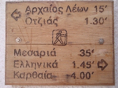
The hiking sign for the walks [1] and [3]. The hiking sign points straight ahead and in this way it takes you 1-2 minutes to reach the large church of Agios Spiridónas, with next to it the beautiful terrace of the restaurant To Stéki. Past the church you keep following the nice and broad main street, which goes up slightly. You leave the houses behind you and you arrive at a marvellously paved trail. On the opposite side of the valley you can already distinguish the continuation of the trail, with underneath the location of the Lion.
View on the location of the Lion of Kéa. Your path curves
to the left, under the cemetery with beautiful cyprus trees; you thus get
a nice view on the town of Chóra behind you. You pass a nice well with
the two-headed eagle and you get a nice view on the Lion as well.
Further on, the trail curves to the left, near a well and underneath the
small chapel of Agios Elefthérios – a great spot to admire the
panoramic view on Chóra. The pavement comes to an end and two minutes
later you get to the small iron gate that gives entrance to the Lion of
Kéa on the left.
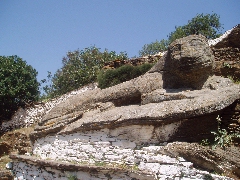
The Lion of Kéa. This magnificent
statue, dating from the years 600 BC is a statue from the archaic era:
the slight smile of the animal reminds us of the smile of the koúros-statues,
so typical for the archaic era (7th – 6th
centuries BC). The lion is probably connected to the legend of the lion
that chased the nymphs. According to the myth, the bloom of the island,
which was then rich in water (hence the ancient name "Hydroussa",
from the ancient Greek "hudoor" = water) and which was the
residence of the water nymphs or Naïades, was brutally disturbed by the
arrival of a lion. The lion chased away the water nymphs, who fled to
the nearby Euboea, which was followed by a long period of drought. This
drought came to an end, only because Aristaeus, son of the god Apollo,
and known as the inventor of the apiculture, brought into existence the
summer wind or meltémi, and this as a result of his sacrifices to the
god Zeus. Maybe, the smile we saw on the face of the lion, was rather a
grin…?
The "smile" of the Lion.
A little caress... (0h18) After this mythological intermezzo you return to the main trail, which you continue to the left; sometimes it is rocky and sometimes it consists of gravel. You have a nice view on the left and behind you and after some 7 minutes you arrive at a large spot around a marvellous plane tree and the beautiful well of Venjamin (Benjamin). The rings in the wall tell you that earlier on, this was a spot often used as watering place and halting place for animals.
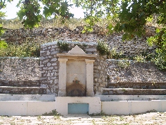
The well of Venjamin.
Writing down some notes next to the well of Venjamin. Straight ahead,
your sandy path continues horizontally and some 2 minutes later you
arrive at a junction with a nice sign post: going down on the left is
trail no. [1], which continues to Otziás (another 1h05), the trail
on the right leads to Spathí (another 1h30).
The hiking sign to Otziás and Spathí. |
(0h27)
This time you have to take a right – from now on, there are markings
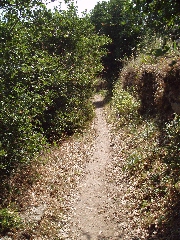
[10]. The trail that follows is very beautiful and still flat,
occasionally in the midst of lush vegetation - a completely different
landscape. Between the well of Venjamin and Agios Dimítrios. Sometimes, you can enjoy to the left a view of the bay of Otziás. After about 10 minutes, you go up on steps and a rocky slope, and you get to a small gravel road, where you go right. But you come almost immediately to the main road, near the small church of Agios Dimitriós - you go left ([10] on a low wall on the left). This road was paved in 2009.
(0h35) On your right you see
now a very beautiful valley deep. You pass first a tiny blue and white
chapel, and after 4 minutes, you arrive near a second blue chapel, with
a sign pointing to the right towards the bay of Spathí.
The valley of Spathí.
(0h55) After a total of 10
minutes, you get again to the asphalt road, which you follow straight
ahead. The old road sign on your way between Chóra and Agii Theódori.
A picturesque road chapel... (1h07) Shortly after, you see the charming chapel of Agii Theódori.
Agii Theódori.
You continue your walk on the paved road.
After a little less than 9 minutes, you continue straight and 2-3
minutes later, you keep to the left - so you follow the road sign to
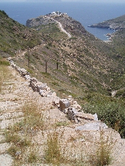
Kastrianí / Otziás. The nice descent to Kastrianí.
The descent that follows is really marvellous: you follow a beautiful
and wide staircase that leads after 12 minutes to the asphalt road that
you follow up.
Panoramic view on Kastrianí.
(1h51) You avoid, staying
left quite, a few furiously barking dogs and so you arrive in the
courtyard, which is very well kept and full of flowers.
The church is
modern and dates from 1910-1912.
The place is cool and nice, you can have a picnic, but there is no much
to see.
Too bad that the beach is inaccessible ... The courtyard of Kastrianí. [For the way back, you should follow the same route. If not, you should call a taxi – so do not forget to note a few taxi numbers before you leave!]
The inaccessible beach...
|
|
