Ioulída - Mýli - Petrovoúni - Sklavonikóla - Agia Marína - Plagiá - Písses |
||
|
Evaluation:
There are
two ways to walk from Ioulída to Písses, one via Mylopótamos (see the
hike Ioulída - Mylopótamos - Fléa - Agia Marína - Písses), the other
passing through the mills and Sklavonikóla.
This
second
hike follows
first of all a few minutes walk [3] and then walk [9], but then it goes
right on the crest of the hill with the windmills. You descend on the
crest of the Petrovoúni, but then you have to follow a long time the
asphalt road and a gravel road – but finally there is still a splendid
trail of 20 minutes to get near the tower of Agia Marína.
Further
on, there are still some gravel roads, but
also a splendid stretch of trail for another 20 minutes.
The Piátsa.
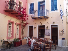
The "stoa" leads to the Piátsa...
The small street on
the left leads to the Kástro (hiking sign [2]), but you take a right
(hiking sign for the hikes [1], [3], [4], [10] and [1]), through a
modern vault, to the centre. After some 20 metres you keep to the right:
in front of you, you can see the church with the red dome of the Agios
Dimítrios. You pass the nice bar + outdoor terrace En Levkoó and via the
Odós A. Lazarídi it takes you a few hundred metres to get to the central
square, the "platía", with the "dimarchío" or town hall.
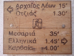
The hiking sign for the walks
[1]
and
[3].
(0h09) You
should take a right here and then, you take not the first, but the
second staircase on the left side (just before an arched passage); you
pass through
two other vaults and then take the 1st on the left. You veer to the
right and take
the 1st staircase
on the left again – you thus keep going higher and higher. After 1
minute this staircase gets to a small concrete street – you go left for
a short while and then you take the uppermost street going up on the
right. About 1 1/2 minute later you get in front of a nice staircase,
which brings you to the asphalt road in about 2 minutes, just next to
Kea Village. Almost straight across you notice a wooden sign "Thólos 20'
/ Kalogerádos 50' / Elliniká 1u45" and that is the beginning of hike
[9]. (0h20)
The staircase
goes up beautifully and it then arrives between walls; you thus climb up
for a fair amount of time – sometimes the steps are rough-hewn in the
rock. After 5 minutes you reach the little asphalt road that runs over
the hill crest with the mills, close to a chapel. Over here, there used
to be 26 mills, mainly on the right, but also on the left – this is the
largest number of mills anywhere on the Cyclades! You follow the road to
the right and so you
arrive next to some wind mills. Pay attention: after 6 minutes and
between 2 + 2 wind mills, you take the little concrete road to the left
[9]: it becomes first a neglected path and then a nice cobblestone
staircase. You thus arrive next to some houses, where you go RIGHT to
follow a little concrete road – hike [9] follows here the gravel road to
the left. After for 50 meters you take a LEFT onto a narrow dirt road.
Looking behind you, on the path on the de Petrovoúni and towards the crest with the mills. Further, you also
discover in front of you the bay of Korissía; the trail now follows
exactly the crest of Petrovoúni, and you continue almost flat.
(1h04) A concrete
road starts here to the right (signpost to Agios Nikólaos and Vróskopos,
no other mark). You follow the road for another 950 meters: after 250
meters, the asphalt ends and after in total of 950 meters and in a right
turn next to a big stable in dark stone, you see a narrow road that
continues straight (orange marks).
The idyllic path between Sklavonikóla and Agia Marína. About 5-6 minutes later, you pass the tower of Panachóras.
The remains of the tower of Panachóras. The trail becomes rocky
next to a water well and later on you continue on a grassy path, always
in the middle of a beautiful vegetation. You approach the tower of Agia Marína. |
You pass through a gate and after
following this beautiful trail for 20 minutes, you get to a concrete road - you
are here on the route of the walk Mylopótamos - Agia Marína – Písses and you
could indeed continue to the right to reach Fléa and Mylopótamos.
The tower and the little church of Agia Marína.
[You
could make a
detour of
3 minutes,
going first
straight
to
the source
of Agia
Marína:
it
is dated
1959
and you see
many
troughs
and a large
washing-place -
this proves that
this place once was
very lively,
which is not
that surprising
in this
very fertile
valley!
You then return
to the cross-roads.]
(1h45) You thus take the dirt road to the right
- a few minutes later, you see on your
left another trail that leads to the source of Agia Marína (sign).
A nice threshing floor of alóni. (2h04) This is a great, natural trail with a wall on the left-hand side. The trail gradually descends with on your left a truly magnificent valley, the valley of Kremastí. The trail is sometimes beautifully paved, especially the second part.
The first part of the monopáti between Plagiá and Písses.
A nicely paved part of the monopáti between Plagiá and Písses.
The marvellous valley of Kremastí, towards Písses. You slowly veer to the right and the broad fertile valley of Pisses appears in front of you. A little later, the descent becomes steeper - there are steps, and the monopáti is sometimes covered with tall grass. You discover rather quickly the gravel road, down in the valley, where you will arrive. But you first turn right again, then left and so you come down in the valley.
The bay and the valley of Písses, a panoramic view from the asphalt road.
After a pleasant descent of
some 20-21 minutes, you get to a dirt and concrete road, that you follow towards
the middle of the valley [12], between high walls, and you finally arrive in the
river bed [12].
Gpx-files:
For
the printer-friendly version |
|


